Laboratory of Civil Engineering
Geotechnical Laboratory:
Objectives: The
student will gain hands-on experience in conducting soil laboratory tests to determine soil parameters
needed for geotechnical engineering design, and to communicate this information with others. Further the
laboratory involves determination of moisture content, density, plastic limit, and liquid limit,
shrinkage limit, bearing capacity, grain size distribution and specific gravity of soil.
Equipments used: oven, consolidometer, shear box, CBR, compaction testing machine, core-cutter, casagrande apparatus, test kit for atterberg limits
Transportation Lab:
Objectives: This lab is used for research and teaching in the fields of rigid and
flexible pavements and testing pavements materials and structures. Several instruments exist in the lab for
conducting materials characterization tests.Equipments used: los angel apparatus, bitumen
extractor, ductility testing machine, bitumen mixer, bitumen penetration apparatus, Impaction test
apparatus, marshal stability test apparatus, film stripping device.
Concrete and Structural Lab:
Objectives: This lab enables students to carry various experiments regarding
compressive strength of concrete, tensile strength of concrete, workability test, design mix, modulus of
rupture of concrete. All these experiments intended to determine the quality of concrete.Equipments
used: vibrating table, compaction factor test apparatus, slump cone, compression testing
machine.
Material Testing Lab:
Objectives: Material testing laboratory helps for selecting and verifying
materials and to evaluate material quality, performance, troubleshooting, research and many other
applications.Equipments used: Le-chatteliers apparatus, vicat’s apparatus, SIEVE SHAKER,
aggregate crushing value apparatus, UTM
Surveying Lab:
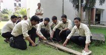
Objective: It includes essential measurements to determine the relative position
of points or physical and cultural details above, on, or beneath the surface of the Earth, and to depict
them in a usable form, or to establish the position of points or details.Equipments used:
Theodolite, level, compass, plane table with all accessories, EDM.
 |
 |
 |
||
 |
 |
